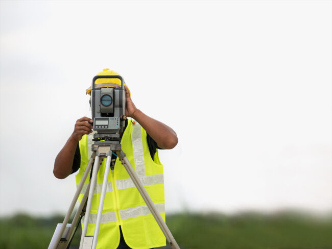
In the intricate world of property development, construction, and land management, precision is paramount. Accuracy in determining land boundaries and understanding the topography plays a critical role in successful project execution. For those involved in land-related projects, a Registered Surveyor is an indispensable resource. This article will explore the vital contributions of Registered Surveyors to precision land mapping and the value they add to various sectors.
The Role of a Registered Surveyor
A Registered Surveyor is a professional with specialised training and certification to perform land and property surveys. They bring precision to the planning and implementation of projects, ensuring that all measurements are accurate and meet regulatory requirements. Their expertise is crucial in a wide range of scenarios, from small property adjustments to large-scale commercial developments.
Surveyors employ a variety of tools and technologies, from traditional theodolites to advanced GPS systems, to gather data and create detailed maps. They provide crucial information that can influence construction plans, legal property descriptions, and even environmental conservation efforts.
Land Mapping Precision
Precision land mapping is a complex task that demands a deep understanding of surveying principles and techniques. Registered Surveyors possess the qualifications to navigate these complexities, ensuring every line drawn adheres to the highest standards of accuracy.
They are capable of measuring minute differences in land elevation, calculating distances with pinpoint accuracy, and delineating property boundaries that stand up to legal scrutiny. This precision is vital not only for current transactions and developments but also for maintaining records that may impact future land use and ownership.
Legally Recognised Professionals
In many jurisdictions, only a Registered Surveyor’s reports and maps are considered legally valid. This legal recognition underscores the trust placed in these professionals and the reliance on their precision. Accurate surveys by Registered Surveyors are often required for property transactions, dispute resolutions, and the establishment of land ownership.
The registration process itself is rigorous, usually involving formal education, practical experience, and examinations. Once registered, Surveyors are often required to undertake continuous professional development to ensure their skills remain current with evolving technologies and regulations.
Applications of Precision Land Mapping
Precision land mapping serves as the foundation for many applications beyond mere boundary identification. Urban planning, infrastructure development, resource management, and environmental protection are just a few of the areas where the skills of a Registered Surveyor are crucial.
The detailed topographical data they provide can reveal the suitability of land for different types of construction, highlight potential risks like erosion or flooding, and inform strategic decisions such as the placement of roads, buildings, and utilities.
Technology in Modern Surveying
Modern surveyors have at their disposal an array of technological tools that enhance precision. Drones, 3D laser scanning, and satellite imagery offer ways to capture comprehensive data about a site more quickly and with greater detail than ever before.
Registered Surveyors are experts in interpreting this data and translating it into accessible formats such as 3D models and computer-aided design (CAD) drawings. They are able to analyse and manipulate this data to meet the specific needs of clients, ensuring clarity and accuracy in every project undertaken.
Choosing a Registered Surveyor
When selecting a Registered Surveyor, it is important to choose a professional with the appropriate credentials and experience relevant to your particular project. A background in the type of surveying required – be it residential, commercial, or infrastructure – is invaluable.
It’s equally important to partner with a surveyor who is knowledgeable about local regulations and planning requirements. This ensures that any work will comply with the legal standards that govern land use and development in the area.
Importance of Professional Affiliations
Professional surveying bodies and affiliations often set the standards for surveying practice and ethics. Membership in these organisations is a good indicator of a surveyor’s commitment to their profession and to upholding the standards of their industry.
Additionally, these bodies often provide platforms for surveyors to exchange knowledge, stay updated on technological advancements, and advocate for the importance of precision surveying in the broader social and economic landscape.
Surveying in Environmental Conservation
Land surveyors also play a significant role in the realm of environmental conservation. Accurate land mapping is essential for identifying and protecting natural habitats, managing resources sustainably, and monitoring environmental changes over time.
Registered Surveyors can assist in delineating conservation zones, tracking the impact of human activities on the environment, and planning mitigation strategies to prevent habitat destruction or pollution.
Surveying for the Future
As our world becomes more complex and the demands on land increase, the need for precise land mapping and professional surveyors becomes more pronounced. These professionals safeguard the integrity of our physical space, ensuring that development is conducted responsibly and sustainably.
For future projects, stakeholders can rely on Registered Surveyors to provide the essential data needed for informed decision-making and to navigate the often complex relationship between human activities and the natural environment.
The Economic Value of Precision Surveying
The economic value derived from the work of Registered Surveyors cannot be overstated. By ensuring accurate land assessments, they facilitate smooth business transactions, reduce conflicts over property rights, and contribute to the efficient use of land and resources.
Their expertise helps to avert costly mistakes and delays, ultimately contributing to the economic vitality of industries and communities as a whole.
In Conclusion
Land surveying is an art that balances precision with practicality. A Registered Surveyor is the custodian of this balance, applying their skill to interpret the lay of the land in service to society’s need for development, environmental stewardship, and economic progress.
For your precision land mapping requirements, consider enlisting the aid of a Registered Surveyor, whose expertise and legal recognition ensure you receive accurate, reliable, and strategically sound surveying services.
Through their meticulous work, Registered Surveyors facilitate a harmonious coexistence between our ambitions for growth and the imperative to respect and protect our natural environment.
